Full-waveform inversion is an iterative optimization technique that produces high-resolution models of the subsurface physical properties. The scheme successively improves the model by minimizing the difference between field data and the data reproduced in a current model. The resulting models can achieve the resolution of half of the propagated wavelength, which is a huge improvement in comparison to classical ray-based tomography methods. Although P-wave velocity is a primary parameter sought in FWI, it also allows to invert for S-wave velocity, seismic attenuation, density and anisotropy parameters. The main disadvantage is the computational cost of the method – even though the idea of FWI was introduced 30 years ago (Tarantola, 1984), only the development in computing in the recent decade allowed for successful industrial application of FWI. Improvements in seismic acquisition are also an important matter, because FWI requires long-offset and low-frequency data. It is a local optimization technique and can result in a local minimum and provide incorrect models if the data is not carefully preprocessed. At the moment we cooperate with the SEISCOPE consortium and use their two-dimensional frequency-domain code (Sourbier et al., 2009a and 2009b) to invert challenging data, including a regional scale onshore survey (Malinowski et al., 2011) and a small near-surface experiment (Adamczyk et al., 2014)
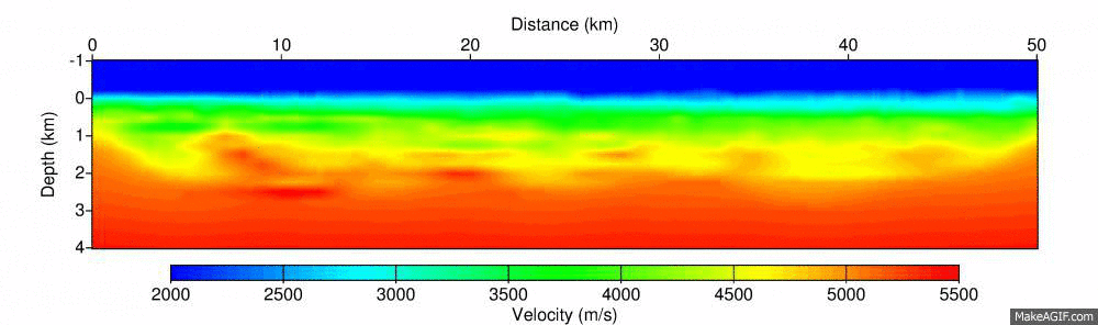
Successive improvement in the resolution of P-wave velocity model of the first 50km of a regional profile from south-east Poland (Adamczyk et al., 2014). Snapshots show the starting model obtained from first-arrival traveltime tomography, and the models after inverting increasing frequencies: 5.3Hz, 5.8 Hz, 6.3 Hz, 7.1 Hz, 8.0 Hz, 8.9 Hz and 9.8 Hz.
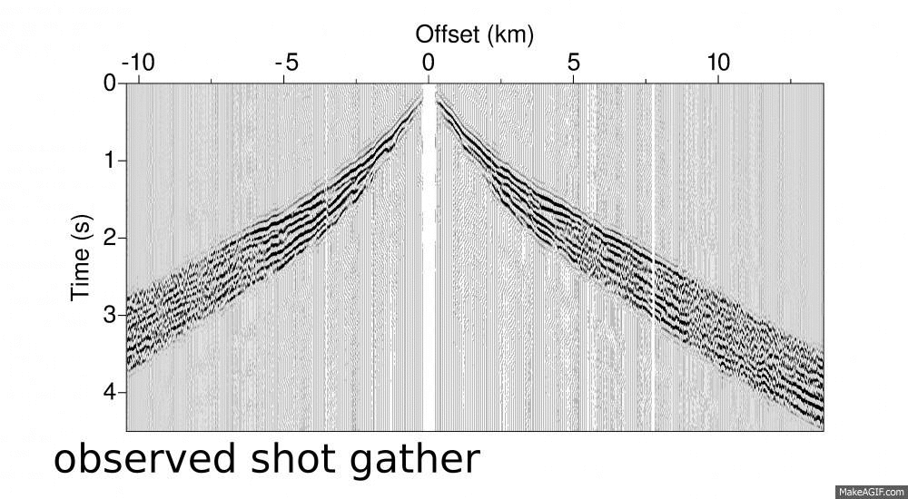
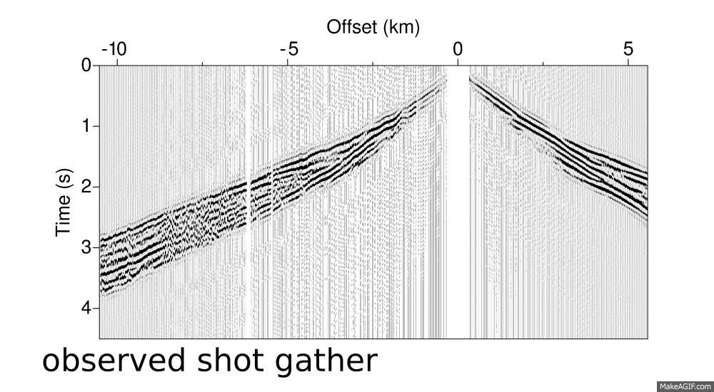
Comparison of sample shot gathers generated in the starting and final velocity models from the previous animation with field data.
Comparison of sample shot gathers generated in the starting and final velocity models from the previous animation with field data.